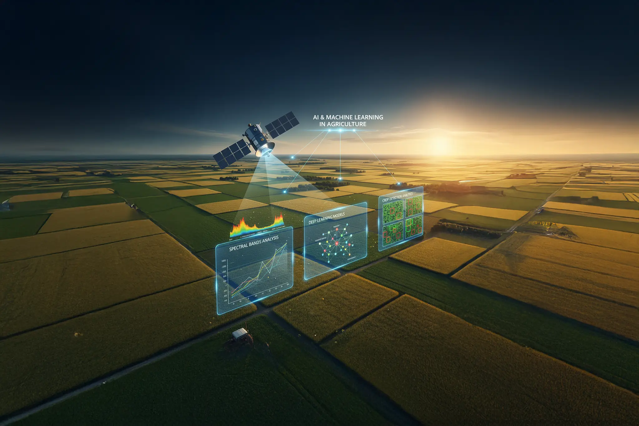
Crop detection using cropIn’s machine learning algorithms
From among at least a hundred different spectral indices, the NDVI (Normalized Difference Vegetation Index) is a vegetation index that is preferred the most by scientists to determine the condition, growth stages, biomass, and the yield estimate of crops. The index quantifies the presence of chlorophyll on land surface and helps assess if the observed region contains live green vegetation by evaluating the distinct colours or wavelengths of VIS and NIR sunlight that the plants reflect.
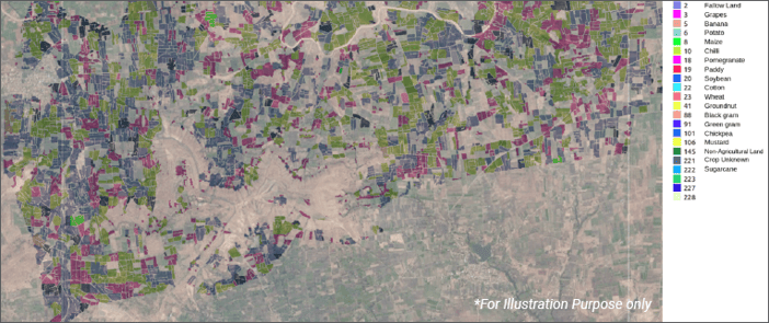
When mapping land-use, CropIn utilises the NDVI time series from Sentinel-1 (RADAR) and Sentinel-2 (optical) satellite-imagery data to distinguish croplands and crop types from other forms of land cover. The pre-existing knowledge of phenological cycles of the different crops facilitates their identification, which is then validated by CropIn’s existing rich pool of crop datasets. Historical information of the plot, also derived from satellite imagery, enables us to get a deeper insight into what the farmer has cultivated in the past, and this intelligence further lends to the data validation when we deploy the crop-detection model for a new plot of farm land. CropIn has developed a state-of-the-art, real-time crop identification system using a bag of deep learning models. The system uses 3D CNN and LSTM architecture to build individual models. While building the models, both pixel- and image-based approach are considered to make a more generalised system. While Sentinel 2’s optical data provides a wealth of information that enables crop detection on a bright, sunny day, if the satellite image is obscured by the presence of clouds, particularly during the rainy season (Kharif season), the system automatically switches to the models that adopt RADAR data (Sentinel-1).
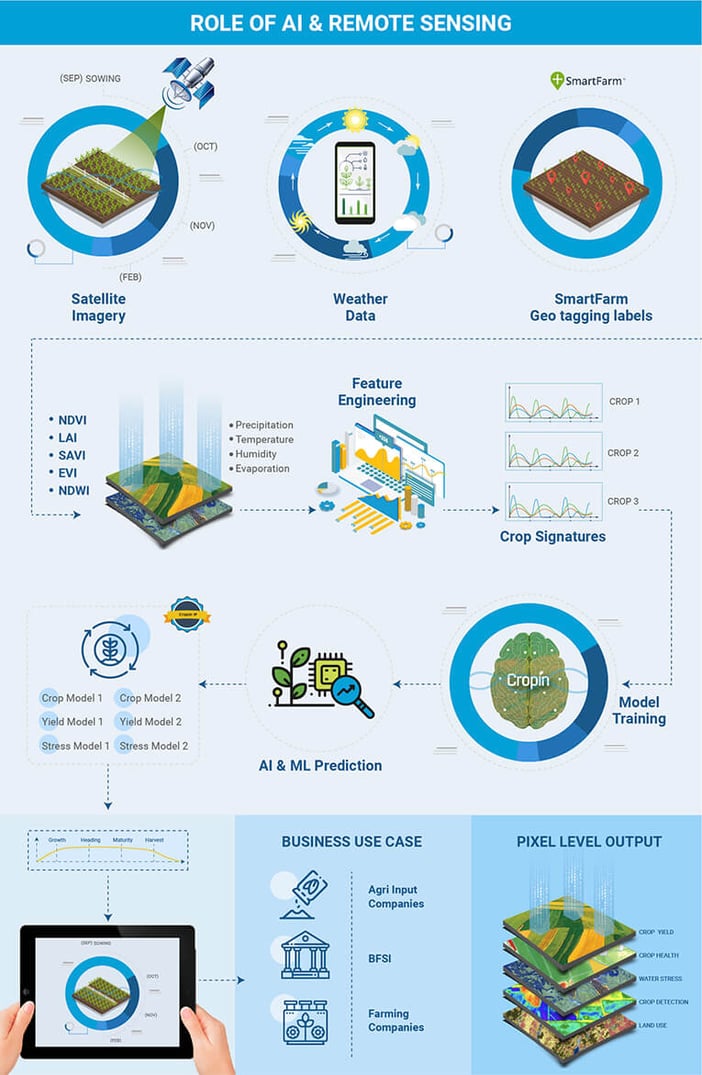
To improve the accuracy of the crop detection model and to validate the result, we train them repeatedly by deploying them on both small territories and across a significantly larger expanse of area, such as a pin code or district. To make the performance uniform across different geographical locations, transfer learning techniques are used to build more region-specific individual models. For the larger area, the crop that the deep-learning engine detects is cross-verified with government data, if available, or with data collected using CropIn’s SmartFarm® for a particular season or crop. Another benefit of using the crop detection model, along with land boundary detection, is that it also helps identify the difference between the farmers assessment of their land area and the corresponding yield and what the algorithm detects. The novelty of CropIn’s system is that it can predict crops at any point in time, from planting to harvest, and there is no need to wait for full time series information.
Precision farming — the gift of agriculture technology
Government agencies : Crop-cutting experiments are now made time- and cost-efficient with the use of crop detection and identification of crop stages at a regional level. Real-time insights improve visibility throughout the cultivation period and also enables government agencies to obtain fairly accurate estimates of crop yields to help officials plan food supply better and speed up insurance claims.
Lending institutions : SmartRisk’s ‘agri-worthiness report’ provides banks with a detailed summary of the crop over the last five seasons for a specific plot. The report makes it possible for the institutions to appraise loan requests and preemptively assess NPA based on the crop(s) cultivated by the farmer previously, the estimated yield, and relative growth index. Officials can also analyse crop growth in real-time by utilising this alternate agri-data.