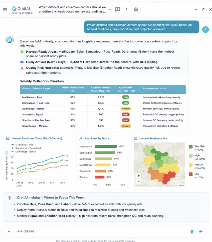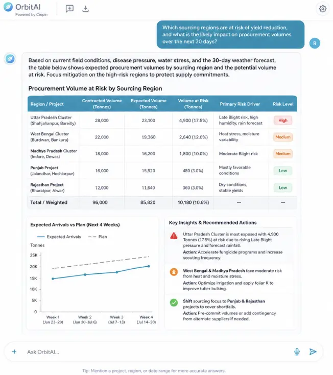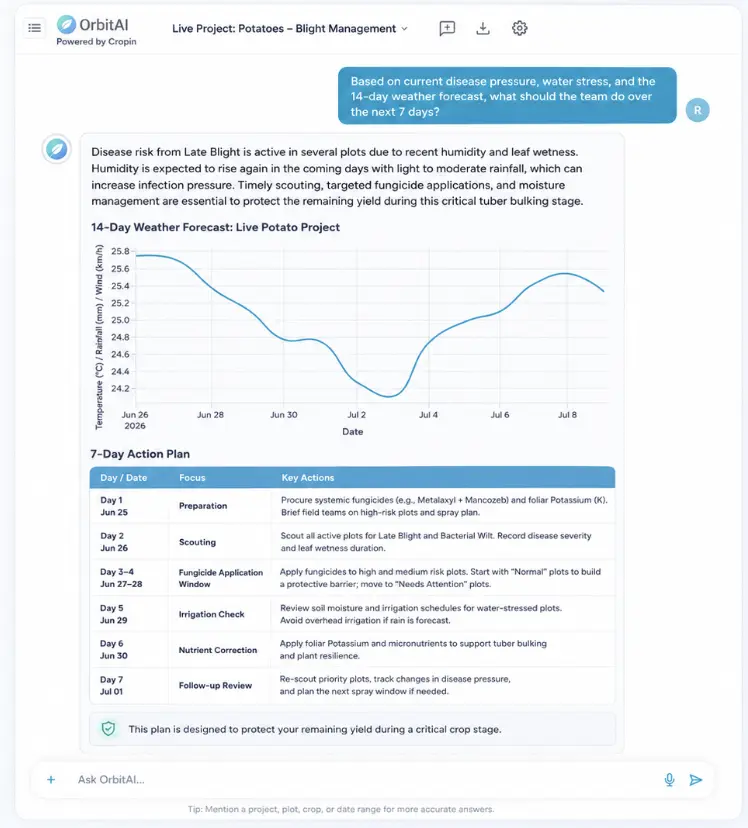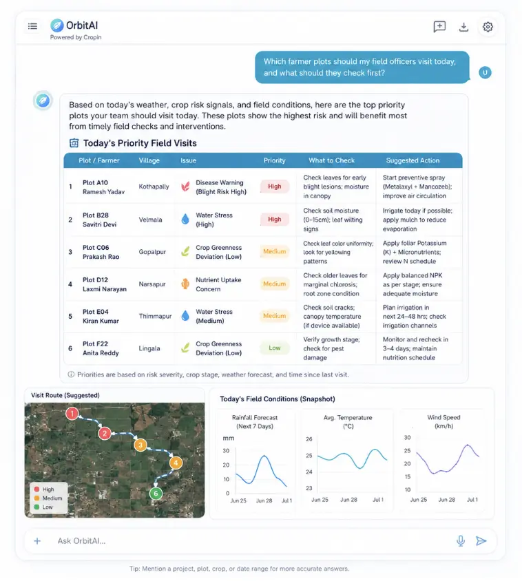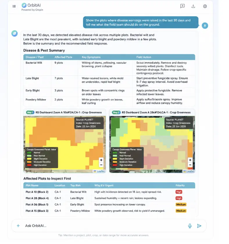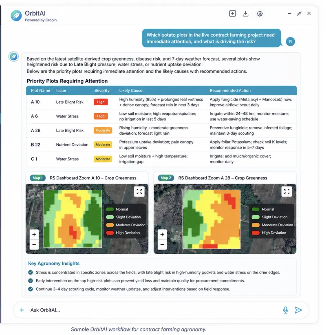
Ask in your own terms.
Ask by chat or voice in the language of your role, asset, region or decision.
Each agent handles one kind of decision: production, sourcing, underwriting, sustainability, agronomy or grower advice. Ask by chat or voice and get an answer, a report and a next step your team can approve.
How it works
OrbitAI finds the imagery, runs the models and writes up the answer. Your team asks the question and reviews the result.
Ask by chat or voice in the language of your role, asset, region or decision.
Cropin’s proprietary pipelines securely bring together licensed and public satellite, geospatial, climate, weather and enterprise data.
OrbitAI invokes the relevant crop, forest, land, water and risk models, knowledge and context.
A plain answer, the evidence behind it, a short report and actions ready for approval.
NO GIS EXPERTISE · NO SATELLITE PIPELINE TO BUILD · NO CLIMATE MODEL TO OPERATE · NO DOMAIN SYSTEM TO MASTER
Available now
Six agents are available now: production, sourcing, agronomy, grower, underwriting and sustainability. Forest & Land and Water models are available, with agents in development. Energy and Infrastructure agents come next.
Open the OrbitAI story ↗OrbitAI in action
Agents
All six share the same field data and models. Each adds the evidence, rules and context its role needs.
Explain crop progression, yield outlook and supply across plots, programs and regions.
Explore Production AgentForecast supply, harvest readiness, procurement exposure and climate disruption across origins.
Explore Sourcing AgentTranslate crop and climate stress into portfolio monitoring, limits, claims and risk action.
Explore Underwriting AgentInvestigate land-use change, EUDR exposure, remediation priorities and audit-ready evidence.
Explore Sustainability AgentDiagnose crop stage, health, disease, water and nutrient signals and recommend intervention.
Explore Agronomy AgentTurn field, crop and weather intelligence into simple, local actions for every plot.
Explore Grower AgentBy industry
A seed company asks which hybrids are performing; a lender asks where borrower distress is emerging. OrbitAI answers both from the same data.
Connect crop condition, weather, harvest readiness and production evidence to operational action.
Compare varieties, diagnose stress and prioritize the activities that protect seed output and farmer outcomes.
Translate field and regional signals into procurement, collection, processing and merchandising decisions.
Ground underwriting, monitoring and expansion decisions in crop, climate and regional evidence.
Use live models and evidence for carbon stock, tree crowns, plantation age and deforestation monitoring.
Connect basin, rainfall, soil moisture, crop demand and asset context to water-related decisions.
Workflow
The same operating loop serves sourcing teams, agronomists, field officers, leaders and growers. OrbitAI makes the decision path visible; people supervise exceptions and consequential actions.
↻ OUTCOMES FEED BACK INTO SENSE, EVERY CYCLE SHARPENS THE MODELS
OrbitAI live experience
Users ask natural questions by chat or voice. OrbitAI brings together Cropin Cloud data, 22+ proprietary models, weather and climate context, geospatial evidence and enterprise permissions to produce role-aware answers and practical next steps.
Coverage
Food-Ag agents are available today. Forest and water have models in use, with agents in development. Energy and infrastructure come next.
Production, sourcing, agronomy, grower, underwriting and sustainability decisions.
Explore Food-Ag ↗Carbon, canopy, plantation, deforestation and compliance evidence; agent workflows expanding.
Explore Forest & Land ↗Water stress, drought and Food-Ag exposure; agent workflows expanding.
Explore Water ↗Vegetation, fire, climate, corridor and physical-asset exposure.
Explore the domains ↗Enterprise control
OrbitAI works within organizational permissions, surfaces the evidence behind its answer and keeps human oversight in the loop for consequential decisions.
Start with one high-value workflow