Synopsis:
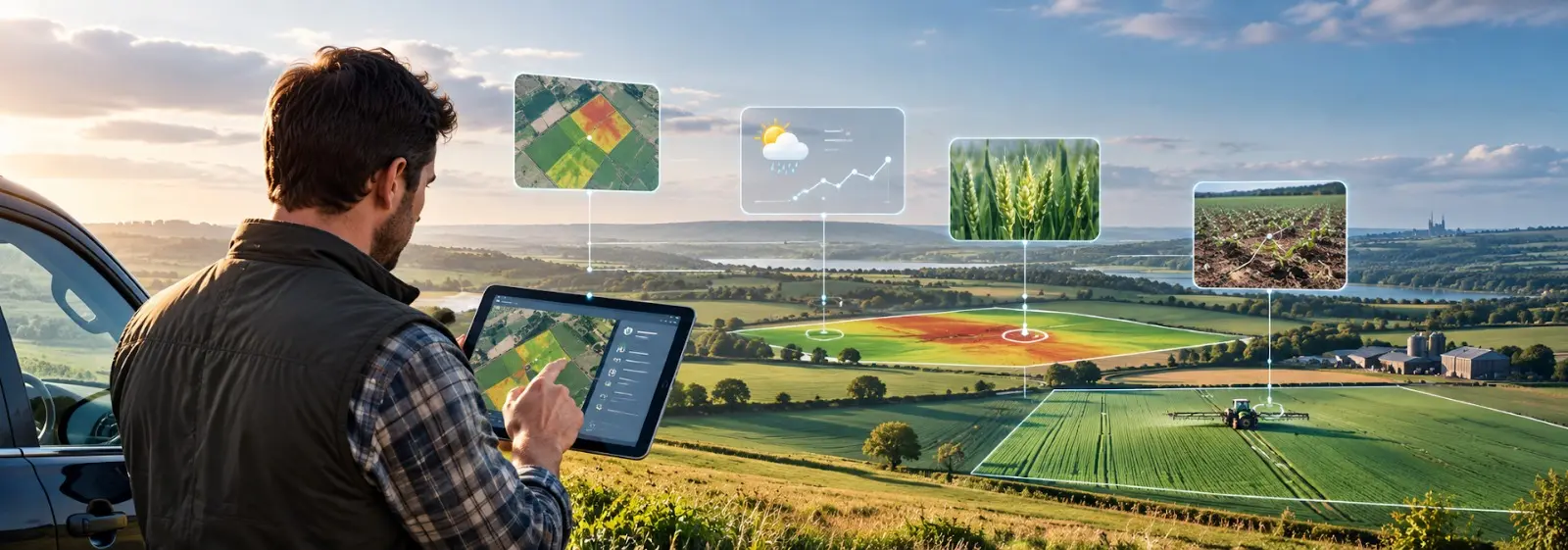
UK farms often need to make decisions within narrow weather and operational windows, while crop conditions can vary significantly from one field to another. This blog explores how real-time crop advisory software can bring together field observations, weather data, satellite imagery, crop-stage information, and farm records to support faster, more informed decisions. It explains how agricultural data moves from field signals to prioritized actions and why simply collecting more data does not always improve decision-making. The blog also highlights how Cropin Cloud can help UK agribusinesses move from reactive monitoring to decision-ready intelligence.
Weather can change farm priorities overnight. A wet field may no longer be ready for machinery, disease risk can increase after prolonged moisture, and crop stress may appear differently across neighboring plots. For UK farms managing these changes across multiple fields, waiting for information to move through several systems can slow down the response.
AI farm advisory software UK solutions can help bring field observations, weather data, remote sensing, crop-stage information, and historical records together so teams can identify what needs attention sooner.
This blog looks at how real-time crop advisory software turns scattered field signals into practical, same-day decisions for UK farming operations.
Why Same-Day Farm Decisions Matter in UK Agriculture
Farm decisions often depend on conditions that can change within hours. A decision that makes sense in the morning may need reconsideration after rainfall, a temperature shift, or a new crop observation.
Prioritizing Fields After a Weather Change
Weather doesn’t affect every field the same way. Soil type, drainage, crop stage, field position, and previous conditions can all influence how a plot responds.
Instead of treating a weather event as a farm-wide issue, decision-ready intelligence can help teams identify which fields are most likely to need inspection or a change in planned activity.
Identifying Where Disease Risk Needs Investigation
Disease risk can develop differently between crops and fields depending on moisture, temperature, crop stage, and local conditions.
Rather than sending teams to inspect every field equally, farm intelligence can highlight locations where conditions suggest that further investigation may be worthwhile. This helps agronomists focus where it matters most.
Responding to Crop Health or Water-Stress Changes
Crop health can change between scheduled field visits. Real-time crop monitoring can provide another layer of visibility between field inspections, helping teams identify changes in crop health and field conditions as they develop.
Remote sensing and other field data can highlight differences that may not be immediately visible from a wider farm-level view. Teams can then combine those signals with on-ground observations before deciding on the right action.
Adjusting Field Work Around Weather Windows
UK farming operations often depend on short weather windows for spraying, planting, fertilization, harvesting, and other activities.
When teams view weather information alongside field conditions and crop requirements, they can make more informed decisions about which operations should happen first and which fields may need to wait.
Prioritizing Harvest and Field Operations
Harvest planning becomes more complex when crops reach maturity at different rates or weather conditions threaten available working windows.
Plot-level information helps teams compare fields, spot changing conditions, and prioritize operations based on what is happening across the farm rather than relying on a fixed schedule.
What Is Real-Time Crop Advisory Software?
Real-time crop advisory software brings together different types of agricultural information and turns them into insights that can support farm decisions.
Instead of simply showing raw data, the system should help answer practical questions:
- Which field needs attention?
- What has changed?
- Which crop and growth stage are affected?
- Why does the change matter?
- What should the team investigate next?
The underlying information may include field observations, satellite and remote-sensing data, weather conditions, crop-stage information, historical records, IoT data, and machinery information.
The important step is connecting these signals with agricultural context. Data becomes more useful when it moves through interpretation, prioritization, and action.
From Field Signal to Farm Decision: How Real-Time Advisory Works
A useful advisory workflow does not begin with an alert. It begins with understanding what is happening across the farm.
1. Capture What Is Happening in the Field
Field boundaries, crop information, observations, activities, and operational records provide the foundation for understanding individual plots.
Cropin Grow can help digitize field operations and capture farm-level information, so teams have a structured view of what is happening across their operations.
2. Bring Field, Weather, and Remote Data Together
Agricultural information often comes from multiple sources. Weather platforms, satellite imagery, sensors, field teams, and farm management systems may each hold part of the picture.
Cropin Data Hub connects agricultural data sources, creating a stronger foundation for analyzing field conditions by structuring data. This ensures teams do not have to use multiple platforms to access various datasets, thereby doing away with information silo.
3. Add Crop and Plot Context
A field signal becomes more meaningful when it is connected to the crop, location, growth stage, historical conditions, and other relevant context.
Cropin’s deep domain AI models leverage our proprietary Crop Knowledge Grid alongside plot-level information to provide crop variety- and stage-specific intelligence. This helps move analysis beyond simply identifying a change to understanding why that change may matter for a particular crop or field. Regarding risk, this helps estimate disease probability based on crop growth-stage analysis. For instance, a late-stage blight in potato is destructive in growth stages like tuber bulking, or the impact of frost is severe during flowering and tuber bulking stages.
4. Detect What Needs Attention First
Not every change requires an immediate response. A useful system must distinguish routine variation from signals that may justify investigation.
Plot Level Intelligence can bring together crop, weather, remote-sensing, and other relevant information at the plot level to identify patterns and prioritize areas that deserve closer attention.
5. Turn the Response Back Into Farm Intelligence
The decision process should not end once a field has been inspected.
Observations, activities, and outcomes can become part of an ongoing digital record. Over time, this creates a richer picture of farm conditions and helps organizations build stronger agricultural intelligence from their own operational history.
Why More Farm Data Does Not Automatically Mean Faster Decisions
More data can create more work when it is not connected properly. A farm may have satellite imagery in one system, weather information in another, field observations in spreadsheets, and machinery data somewhere else. Teams then need to compare these sources manually before they can decide what matters.
This creates a common chain of problems:
Disconnected data → delayed interpretation → too many alerts → slow field response
This is where farm decision support software can play a useful role. The objective is not simply to collect more information but to organize relevant signals around the decisions that farm teams actually need to make.
Cropin Data Hub supports this connected approach by enabling easy management and access to different agricultural data sources. The data collated is structured through an agri-object model. The intelligence layers can help turn that information into more actionable field-level insights.
Moving From Reactive Monitoring to Decision-Ready Intelligence
The difference between monitoring and decision support is what happens after you detect a change.
Reactive model
Decision-ready model
See a problem in the field
Identify changing risk earlier
Review several separate systems
Bring relevant signals together
Inspect every field equally
Prioritize plots needing attention
Receive generic notifications
Receive crop- and plot-contextual insight
Respond after symptoms become obvious
Support earlier investigation/intervention
Record activities manually
Build an ongoing digital farm record
For organizations evaluating precision agriculture software UK solutions, plot-level visibility can help connect remote sensing and field data with practical farm decisions.
How Cropin Turns Agricultural Data Into Actionable Intelligence
Technology becomes more useful when each component contributes to a larger decision-making process rather than operating as a standalone tool.
Cropin Grow - Capture and Digitize Field Operations
Cropin Grow provides a digital layer for capturing farm operations and field information. Teams can record details such as field boundaries, crops, activities, and observations, creating structured information that can support further analysis. Cropin App, the mobile interface allows multiple modes of data ingestion.
This provides an operational foundation for understanding what is happening across individual fields.
Cropin Data Hub - Connect Agricultural Data Sources
Cropin Data Hub connects different agricultural data sources, including field information, IoT, machinery, satellite or drone data, and weather information.
By bringing these sources into a connected data environment, organizations can create a more complete view of field conditions and reduce the need to work across disconnected systems.
Plot-Level Intelligence - Convert Data Into Predictive Field Insights
Plot-Level Intelligence brings agricultural data down to the level where many farm decisions are actually made. Cropin’s 22+ conceptualized AI/ML models overlay crop health, crop stage, weather, remote sensing, yield-related information, and other signals to identify patterns across individual plots. Cropin provides predictive and prescriptive insights for dynamic decision-making on and off the field, supporting decisions around field visits, crop management, harvest timing, and changing field conditions.
This is also where agricultural decision support software becomes more useful than a simple monitoring dashboard. The value comes from connecting information to context and helping teams decide where attention is needed.
Cropin Connect - Get Advisories and Alerts Closer to the Field
Insights only have value when they reach the people responsible for acting on them.
Cropin Connect supports communication between agricultural teams and growers by helping deliver advisories, alerts, and relevant information closer to the field. This can help reduce the gap between identifying a condition and communicating what teams need to know.
OrbitAI - Move From Finding Data to Asking What Needs Attention
OrbitAI adds an AI-driven layer to agricultural intelligence. Instead of requiring users to search multiple datasets for an answer, natural-language interactions let teams ask questions about their agricultural data.
Its agronomy-focused capabilities can support the identification of crop health changes, stress conditions, pest and disease risks, and fields that may require attention. This shifts the experience toward asking, “What needs my attention today?” rather than simply, “What data do I have?”
What Should Real-Time Crop Advisory Software Deliver to UK Agribusinesses?
The value of advisory software depends on whether it supports real farm decisions rather than simply producing more information.
Current Field Visibility
Teams need a current view of what is happening across fields, including changing crop conditions, weather influences, field observations, and operational activity.
Instead of relying only on periodic field visits or static reports, a connected view can help farm managers understand how conditions are developing across different plots. This makes it easier to spot changes early and decide where closer inspection may be needed.
Crop- and Stage-Specific Context
A signal means different things depending on the crop and its development stage. A change in vegetation, moisture, or temperature may have different implications during establishment, vegetative growth, flowering, or maturity.
Advisory systems should connect field information with crop and growth-stage context so that insights are relevant to the situation rather than presented as generic alerts.
Actionable Prioritization
Farm teams have limited time to inspect every field every day. Software should help highlight which plots may need attention first and provide enough context for the team to decide what to investigate.
Prioritization can consider factors such as crop condition, weather, recent observations, and historical field patterns, helping teams focus their time where it can have the most practical value.
Integration With Existing Farm Data
Agribusinesses already generate large amounts of information. Advisory software should work with existing field, weather, satellite, machinery, IoT, and operational data rather than creating another isolated source.
Bringing these inputs together gives teams a more complete view of field conditions and reduces the need to manually compare information across multiple platforms before making a decision.
Clear Delivery to Field Teams
Insights need to reach agronomists, farm managers, growers, and other relevant users in a form they can act on. A useful advisory process doesn’t stop at identifying a change; the information also needs to reach the people responsible for inspection or field operations.
Clear alerts, advisories, and communication channels can help reduce the gap between identifying an issue and responding to it.
Human Agronomy in the Decision Loop
Technology can identify patterns and prioritize information, but agricultural decisions still require professional judgment and knowledge of local conditions. Agronomists and farm managers can combine technology-generated insights with field experience, crop knowledge, and grower observations.
Real-time advisory software should support that judgment by bringing relevant information together, rather than attempting to replace the people responsible for making the final decision.
Conclusion
UK farms operate in conditions where weather, crop health, field readiness, and operational priorities can change quickly. Real-time crop advisory software can help connect these signals and turn them into more timely, context-aware intelligence.
Cropin brings together farm digitization, connected agricultural data, Crop Knowledge Grid, plot-level intelligence, field communication, and AI-driven capabilities to support this process. The goal is simple: give agricultural teams better information about what is changing, where it matters, and where human attention may be needed next.
Turn field data into timely agricultural intelligence with Cropin. Connect farm, weather, satellite, and AI-powered insights to support faster, better-informed decisions across UK farming operations.
Frequently asked questions (FAQs)
1. What is real-time crop advisory software?
Real-time crop advisory software brings together field observations, weather data, satellite and remote-sensing information, crop-stage data, and farm records to provide insights that support faster and more informed agricultural decisions.
2. How can crop advisory software help UK farms make same-day decisions?
It can help farm teams identify changing field conditions, prioritize plots that may need attention, adjust operations around weather windows, and respond to crop health or water-stress changes with greater context.
3. What types of data can be used for real-time crop advisory?
The data can include field observations, satellite imagery, weather information, crop-stage details, historical records, IoT data, machinery information, and other operational farm data. Bringing these sources together provides a more complete view of field conditions.
4. How does plot-level intelligence support farm decision-making?
Plot-level intelligence connects crop, weather, remote-sensing, and other agricultural information at the individual field level. This can help teams identify patterns, prioritize areas for investigation, and make decisions based on the conditions of specific plots.
5. Can agricultural advisory software work with existing farm data?
Yes. A connected advisory system can work with existing field, weather, satellite, machinery, IoT, and operational data. Bringing these inputs together can reduce the need to manually compare information across separate platforms.
6. Does crop advisory software replace agronomists and farm managers?
No. Technology can identify patterns and prioritize information, but agricultural decisions still depend on professional judgment and knowledge of local conditions. Advisory software is intended to support agronomists and farm managers with relevant, timely information rather than replace their expertise.
Author Bio

Shashi Kant
Shashi Kant leads customer experience for the EMEA region at CropIn Technology Solutions, bringing a rare blend of technical depth and client-first thinking to the agri-tech world. With extensive expertise in implementation, pre-sales, and client onboarding, SHashi specializes in turning complex AI-driven data into smooth, successful adoption journeys. He works at the intersection of technology, agriculture, and human experience, ensuring that innovations such as satellite analytics, IoT-driven insights, and machine learning models deliver clear, measurable value. By bridging the gap between corporate sustainability goals and on-ground farming realities, Shashi helps our partners navigate the digital transformation of their food systems. He is dedicated to driving regenerative agriculture practices that benefit both the enterprise and the grower.